FEATURED TRAIL
Burke Park (Peets Hill)
Description
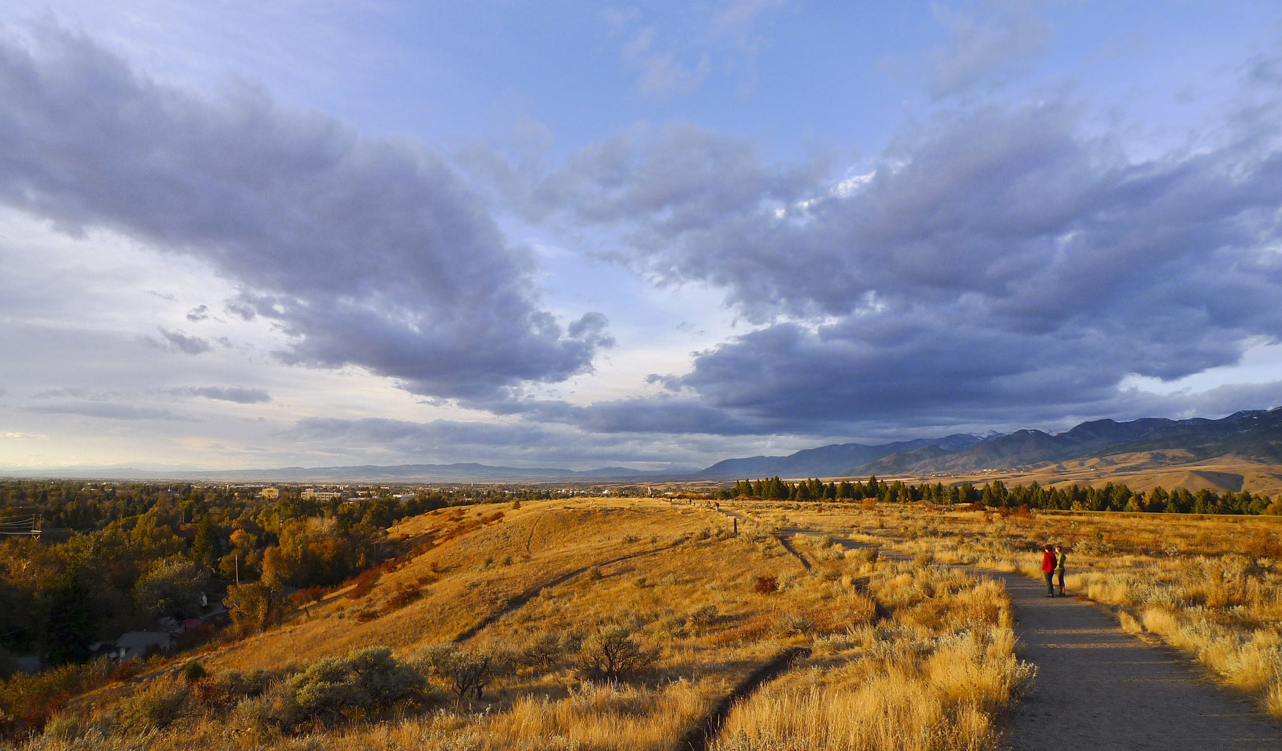
Burke Park, commonly known as Peets Hill, was GVLT’s very first trail project. Still a hometown favorite on the now 100-mile-long Main Street to the Mountains trail system, hundreds visit Burke Park every day to walk, run, bike, let their dogs romp off-leash, or enjoy Bozeman’s best sunset view.
Despite its popularity and location just blocks from Main Street, the 60-acre park is home to more than 220 species of plants. In the winter, the hill is known for its high-speed sledding, but old-timers remember when it used to hold a lighted ski jump. See additional information on the City of Bozeman’s website.
-
🟢 🟦 Easy to Moderate
-
3.2 miles of available trail
-
Combination of gravel paths and natural surface singletrack trails
-
Walking, hiking, running, biking
-
The trails can be icy in the winter and muddy in the fall and spring.
-
The primary parking lot is on Church Avenue at the intersection with East Story Street. There is a secondary parking lot at the top of Peets Hill located at the intersection of Josephine Drive and Kenyon Drive. The trails are also accessible from the south end of the Bozeman Library parking lot via a paved section of the Gallagator trail, which passes through Bozeman’s Sculpture Park.
-
Allowed off-leash (unless designated otherwise)
-
This park includes public bathrooms located at the parking lot on Josephine Drive, benches along the trail, and two overlooks offering spectacular views of sunsets and all of Bozeman. At the highest point of Burke Park, you’ll find a Mountain Range Finder and Medicine Wheel, which identifies the prominent peaks of the Gallatin Valley and honors the region’s Indigenous history.
-
The Church Avenue parking lot has two accessible parking spaces for use of the lower portion of Burke Park and the Gallagator Trail. Gravel trails in the lower portion of Burke Park include steep grades and may not be accessible for all.
The Josephine Drive parking lot has one accessible parking space for use of gravel trails leading to an overlook, the Mountain Range Finder and Medicine Wheel, and an accessible loop trail on the crest of Burke Park.
-
Call Bozeman Parks and Recreation at 406-582-2290.
Photo: Kurt Wehde
Trail History
This land was platted for 612 homes in 1892 when Bozeman was trying to demonstrate the urban density and sophistication worthy of a state capital. More than a century later, it instead remains precious open space thanks to the tireless work of the community. In fact, the creation of Burke Park was GVLT’s first community trails project back in 1993.
GVLT’s founder, Chris Boyd, was instrumental in negotiating the purchase of the land, and a portion of the trail is named the "Chris Boyd Memorial Trail" in his honor. On our 25th anniversary, we further recognized his work at Burke Park and across the valley with the installation of the Chris Boyd Bridge over the seasonal creek at the base of the hill. A reflection of the natural beauty around it, the bridge improves safety and water quality and welcomes the park’s many users onto the trail.
In 2022, 12 acres at the south end of the park were listed for sale. This parcel was privately owned and often taken for granted as an extension of the park. GVLT, with our partners at the City of Bozeman, moved swiftly within 24 hours to make an offer for purchase. Despite our best efforts, the property went under contract with another party. We were crushed—until we learned the original contract fell through and GVLT was next in line to purchase the land. The campaign for “Peets Final Piece” began and within hours of the announcement, Peets enthusiasts from around the country made contributions. Over several months, 700 people, businesses, and partners made donations of all sizes to help us reach our goal—officially securing Peets Final Piece. Ownership of the parcel was transferred to the City of Bozeman, guaranteeing it will remain public parkland forever.
Following purchase of this extension, GVLT made several Burke Park improvements, including adding two new scenic overlooks, extending the Chris Boyd Memorial Trail down to Church Avenue, upgrading the walking loop at the top of Burke Park to an all-persons trail, and installing a unique Mountain Range Finder and Medicine Wheel.
About the Mountain Range Finder and Medicine Wheel
Visitors will discover a round overlook surrounded by a circle of large rock benches. The backrests on the benches are metal silhouettes of the mountain ranges encircling the Gallatin Valley with prominent peaks labeled. As you stand in the middle of the overlook, you will see the silhouettes and peaks align with their physical location.
The center of the circle is a concrete Native American Medicine Wheel. The Medicine Wheel, sometimes known as the Sacred Hoop, is a symbol that has been used by generations of various Native American Tribes for health, healing, and ceremonial purposes with four segments aligned with the cardinal directions.
The Gallatin Valley, considered a common hunting ground, has ties to many tribes, some of which do not have treaty land within Montana. Taking a cue from the Drum Hall in American Indian Hall on the Montana State University Campus, an additional ring of concrete, divided into eight segments, encircles the wheel. Each segment represents one of the treaty lands located in the State of Montana. The segments are arranged such that if one were to stand in the geographic center of Montana, the segments are placed in the general direction of the treaty lands and include a plaque with the names of the associated tribes.
We were honored to have listened and learned from tribal members and the MSU community as we designed and planned this important addition. GVLT and the City of Bozeman are proud to honor the many tribes who have historically used the Gallatin Valley.

